Broadening our horizons: implementing the Historic Environment Strategy for HS2 Phase One
This paper discusses the implementation of the Historic Environment Research and Delivery Strategy (HERDS) for High Speed Two (HS2) Phase One, London to Birmingham. It discusses the question-led approach to the historic environment programme set out in HERDS and considers approaches to both prospection for archaeological remains and selection for further investigation and mitigation. Challenges inherent in the archaeological resource are considered, such as the presence of ‘blank’ areas and less visible forms of archaeology. A focus on a landscape scale context for the consideration of the significance of archaeological remains is emphasised and the potential varying intensities of past activities across different landscape contexts over time is highlighted. The paper argues that decision making for mitigation should move away from a site by site approach and consider the broader context of significance wherever possible, even where a scheme is necessarily divided up into construction assets and across multiple contract boundaries by the needs of the construction programme. The implementation of the Historic Environment Strategy raises a number of key considerations for large scale infrastructure projects and through a question-based approach presents a challenge to the industry for the consideration of significance, spatial context and the consideration of targeted archaeological responses.
Introduction
The High Speed Two (HS2) Historic Environment Research and Delivery Strategy (HERDS[1]) was developed as a response to the mitigation for Phase One of HS2 and is a key part of the Environmental Minimum Requirements (EMR) through the Heritage Memorandum[2]. It proposed a question-led approach to the mitigation of the historic environment where significant questions and objectives were defined at the outset of the project, designed to directly influence the selection of sites for mitigation. The aim was to move away from a small-scale site by site approach, where the presence of remains often invokes a standard mitigation response, to a broader consideration of significance and purpose.
This has presented a challenge to the industry, which is used to working at much smaller scales and where the presence of archaeological remains often necessitates a mitigation response, in order to ultimately contribute to broad, varied and potentially unspecified research goals once that mitigation has been completed. The challenge in implementing HERDS has been to move away from a piecemeal site by site approach, to considering the broader significance of those sites at a much larger scale and recognising the opportunity that HS2 presents as a linear transect through southern and midland England.
This paper will discuss the challenges around implementing a selective and question-led approach, the methodologies involved in establishing a baseline of data that can feed into mitigation decision making and the challenges to the industry of moving from the consideration of small scale ‘sites’ to large scale landscapes.
HERDS and the question-led approach
The scale of HS2, over 200km long from London to north of Birmingham, necessitated an approach that considered the significance of the archaeological remains encountered and a proportionate response to their mitigation. The HERDS strategy was, therefore, developed with a series of specific objectives around knowledge creation, community engagement and skills, in order to provide a focus to the works and contribute to public benefit from the work undertaken. This paper will focus on the knowledge creation aspect of the strategy and in particular the archaeology (as opposed to built heritage) of HS2 Phase One.
It is clear from an archaeological perspective that HS2 Phase One provides an opportunity to examine an unprecedented transect across the landscape and to examine patterns of past activities across varied geological and topographical areas and across time. It will enable data to be interpreted at potentially broad scales across the transect and provide comparative data for recent broad scale studies such as the Englaid Project, which examined development-led archaeological data from across the country[3][4] , the Rural Settlement of Roman Britain project [5][6][7][8] and past syntheses such as The Prehistory of Britain and Ireland [9].
A review of the Environmental Statement (ES) data for Cultural Heritage[10], the existing regional and national research frameworks, along with academic publication and professional knowledge, resulted in the creation of a resource assessment characterising the known archaeology along the route and its broader context. This baseline study was augmented by a series of workshops with the academic, professional and local government archaeological sectors along with Historic England and representatives of community groups. This resulted in a series of specific objectives which cover all the principal archaeological periods from the lower Palaeolithic (c. 500,000 BP) through to the 20th century and range from locally specific and regional to route wide in their focus. Methodological considerations included ground-truthing LiDAR and testing, ground-truthing and developing geophysical survey techniques, as well as considering the effectiveness of those techniques.
Following a baseline of data established through the ES and the HERDS resource assessment, , the challenge is ultimately to design mitigation which will provide a means for the specific objectives to be addressed. This requires an enhanced baseline of information for which targeted intrusive investigations can be focused. Although the general archaeological narrative for a region and the gaps in knowledge may be understood for any given period, any resource assessment still requires further information on potential sub-surface deposits, in order to aid the selection of specific locations for investigation.
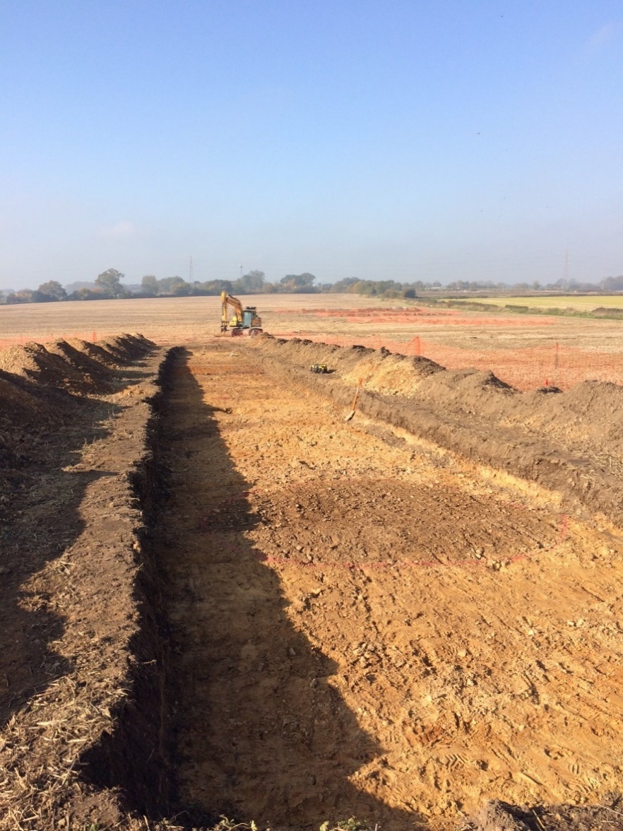
A series of HS2 technical standards underpin the works and include, for example, detailed desk-based assessment, non-intrusive geophysical survey, artefact collection strategies, and trial trenching. These have been employed incrementally, across parcels of land defined by construction design elements. The implementation of the works is, therefore, divided necessarily by units of land defined by the construction programme, as with any construction project. The challenge is to look beyond those land units and to consider a broader context for the archaeology identified, if we are to place that archaeology into the context of the many route-wide specific objectives in HERDS. Clearly the ‘site’ as defined by construction boundaries is an artificial construct in the context of historical land use and development, and inevitably cuts across patterns of landscape that have developed cumulatively over hundreds of years if not millennia.
Development-led archaeology between the introduction of Planning Policy Guidance 16 (PPG16) in 1990 and the current National Planning Policy Framework[11] has been very successful in identifying and increasing our knowledge of the past, but also places challenges on the ability to record all such remains within development programmes. The challenge for the HERDS as part of the HS2 Heritage Memorandum[2], is to question the significance of the archaeology identified, its potential for knowledge creation and ultimately contributing to public benefit. Clearly the counter argument to this approach is that all archaeological remains can add to a broader understanding of the past, and it is the challenge of the HERDS to add to existing knowledge through targeted approaches which seek to mitigate on the basis of potential to answer those specifically defined questions. In effect the HERDS has taken the concept of the regional and national research frameworks (which aimed to focus upon research priorities for archaeology) and attempted to distil and implement them through a defined and selective strategy for archaeological investigation in one project. That places a new perspective on the works undertaken and the decisions that are required to be made. More often than not, archaeological mitigation considers questions of research value and contribution to the objectives of research frameworks after the event of excavation, rather than placing those objectives front and centre of planning the mitigation. Central to the challenge of a question-led approach is, however, the presence of the ‘unknown’ within the landscape under investigation. This is discussed below.
Challenges within the archaeological resource
Specific objectives which focus on themes of research for the past inevitably require greater definition through further work, in order to establish a clear and more detailed baseline from which we can begin to address them. It is not possible, for example, to contribute to an understanding of the regional variability in the form and location of late prehistoric settlement sites, if we don’t know where those settlement sites are located.
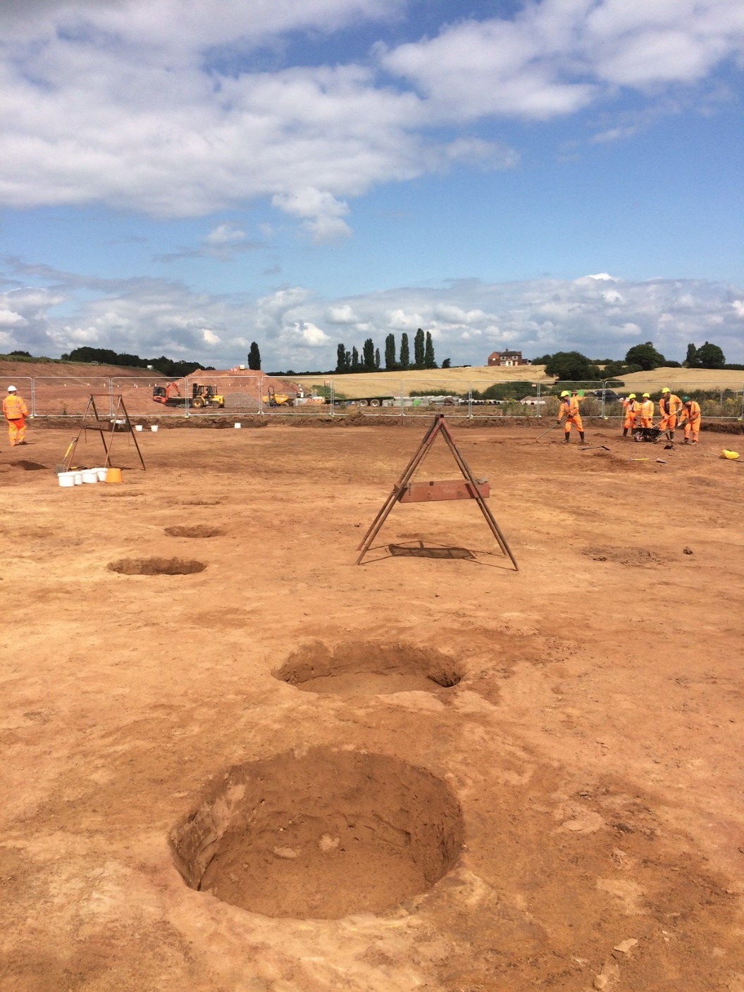
Route-wide geophysical surveys have helped considerably in the identification of previously unknown late prehistoric, Roman and later settlement, which have the potential to contribute to recent studies on the form, character and pattern of Roman rural settlement in England[5] . Where geophysical survey results have been less clear, trial trenching has also regularly identified settlement of a similar character and period within the scheme. It has long been recognised, however, that trial trenching is less successful at identifying certain types of archaeological deposits from certain periods and even where the intensity of trenching is increased significantly, there is still a considerable chance that certain types of archaeology will not be identified[12][13] . Large scale area stripping may increase the potential to encounter the more discrete remains, such as Neolithic to Early Bronze Age funerary and ceremonial monuments, although by their very nature associated settlement remains are particularly insubstantial-reflecting varied, ephemeral and mobile patterns of settlement in the past[14] .
Where geophysical survey and trial trenching are good at being able to identify the more substantial traces of enclosed settlement and land division, they are less frequently able to identify archaeology from certain other periods which may have been characterised by more ephemeral activities. This, therefore, is problematic when attempting to answer questions particularly for earlier prehistory or other periods where traces of past human activity left less substantial archaeological remains such as the early medieval period (c.AD410-1066). The danger is that the archaeological results reflect and reinforce a bias towards the more visible and readily detectable forms of past settlement activity and that we are unable to increase our understanding of those periods that have left less-substantial signatures[13] .
The HERDS approach to prospection
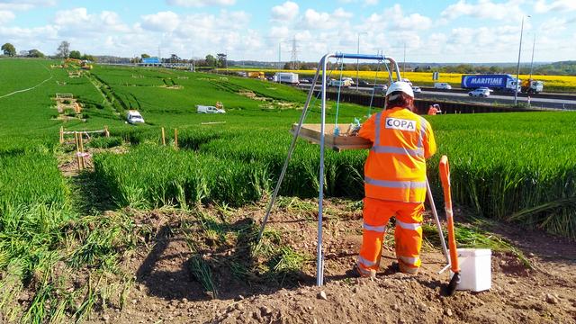
A range of industry- standard prospection techniques have been employed as a means of more certainly establishing the ‘baseline’ of archaeological deposits across the route of Phase One. These include detailed desk-based assessments, a route-wide palaeo-environmental assessment; geophysical survey; LiDAR; metal detecting (pre-excavation surveys and during excavation); evaluation trenching; extensive test pitting of topsoil; a geo-archaeology programme; a risk model for archaeological potential; and scope for the application of alternative and innovative techniques.
Field evaluation trenching remains the staple prospection tool within archaeological fieldwork practice, although it has long been known that the technique lends itself to the identification of certain types of remains more readily than others and is more likely to identify activity from certain periods of the past. Adopting ploughsoil test pitting and metal detecting, for example, has been intended to augment trenching results and provide a more balanced reflection of past activities at a broader scale. Fieldwalking, although valuable in providing extensive material data from the ploughzone, has been employed less frequently, since the practicalities of land access, agricultural regimes and commercial construction programmes often inhibit the application of this technique. A geo-archaeological desk-based assessment has provided a clearer understanding of potential of deposits across the route and has provided a platform for both geo-archaeological investigation but also a context for potential archaeological deposits. As a response to the challenge of extensive ‘blank’ areas and in response to the encouragement for innovation at HS2, the Historic Environment team within the Fusion JV have been exploring the potential of predictive models for the application of targeted test pitting surveys, along with innovative techniques such as geo-chemical survey.
Blank areas
The concept of ‘blank’ areas has become a key topic of debate whilst implementing the HERDS on Phase One. There are clearly areas where extensive and substantial archaeological remains have been identified along the route, and this can be seen particularly clearly through the results of large-scale geophysical survey. The areas between those known settlement foci could easily be interpreted as ‘blank’. It is recognised, however, that whilst these areas may not have witnessed substantial, permanent or sustained activities in the past they may, nevertheless, have been subject to infrequent, short term or location specific activities that are less easy to recognise through standard evaluation approaches. This interpretation brings certain HERDS objectives into focus and highlights the need to consider past settlement at a broad landscape context.
A ‘blank’ area may be blank because industry standard techniques have failed to identify archaeological remains, but if we trust these techniques to identify the more substantial forms of settlement, the possibility that there may also be areas of the landscape that saw different and lower levels of activity in the past, and that certain periods may leave traces that are not identifiable through standard approaches, has to be considered. The problem lies in the fact that certain periods of the past appear to have left very little, or sporadic traces of activity or where activities beyond foci such as funerary and ceremonial monuments is difficult to detect. It is clear, therefore, that ‘blank’ areas should be seen in the context of broader levels of activity in the wider landscape, which may be of no less importance to our understanding of the past. It is this broader landscape context that provides a challenge to the concept of the ‘site’.
The site and the landscape
A site as it is most readily recognised through archaeological practice, arguably represents the location of repeated and intensive activities, particularly from periods where material consumption and production were higher (e.g. in the Roman, medieval or post-medieval periods). We must, therefore, always see ‘sites’ (the enclosures, pits, ditches and postholes we routinely excavate) as part of a broader whole of human activity across the landscape and recognise that those foci may have varied across time. The mitigation of a ‘site’ is, therefore, the investigation of the most readily identifiable and potentially repeated or intensive expression of past activity in a given period or periods. In order to gain a fuller understanding of the past we need, as far as possible, to understand any such site in its broader context both geographically and across time. That can be achieved at a variety of scales from the examination of pollen or charred plant remains to reconstruct environmental conditions, the study of pottery and other material remains to reconstruct patterns of trade and exchange and less tangible forms of human social interaction, to the examination of the distribution of artefacts in the landscape to understand landscape preferences for settlement location. The mitigation of a ‘site’ is one way of understanding human activity in the past landscape, but the degree to which any such location can progress our understanding of the past and our research questions also needs to be considered more broadly.
There were clearly foci within the landscape across time, whether they were funerary monuments in the Neolithic and Early Bronze Age, roadside settlements in the Romano-British period, natural landscape resources exploited for raw materials, areas of agricultural suitability or less tangible ‘natural places’ of significance[15] . There is also a potential cumulative effect for activity foci in the landscape, particularly where they may have been perceived as significant or special. Places may have been re-visited and re-interpreted over time so that activity at any one location may have been re-visited much later, when the significance of a location may have been re-interpreted or re-imagined[16] . The re-use of a location of significance may be exemplified by emerging results at the HS2 excavations near Wendover in Buckinghamshire, where re-use of a monumental location across a significant period of time from the Late Neolithic and Early Bronze Age (c.2900-1500BC) through to the Late Iron Age (c.100BC to AD43) and Romano-British periods (AD43-AD410) appears to have been identified. There is, therefore, no doubt that certain locations in the landscape received specific, potentially intensive and repeated attention in the past.
It is necessary, however, to always view these locations of intensive and repeated activities within a broader context of settlement in landscapes of the past. Parallels could be drawn, perhaps, with the concept of setting which seeks to consider the broader environmental context of heritage assets such as buildings or upstanding monuments[11]. When archaeology is considered at a landscape scale, sites are effectively ‘nodes of more concentrated activity within a larger area over which activities were conducted in the past’ [17]. Those areas of concentrated activity clearly change over time, settlement location may shift and move across short-term, seasonal or longer timescales and may be subject to the influence of changing environmental, social or political conditions.
It is clear that any number of activities may have taken place within broad scale landscapes of the past, with some activities being more ambiguous than others, yet reflecting patterns and systems of settlement that form part of a broader whole. When examining the archaeology of the later Bronze Age, for example, rivers and wet places were clearly a focus for the deposition of metalwork whether as a display of conspicuous consumption in view of others, or a votive offering to the gods[18] . The extent to which those locations represent associated areas of settlement in the landscape is uncertain and they may represent episodic activities located purposely away from more sustained locations of occupation. Another example would be burnt mounds, regularly recorded for the Middle to Late Bronze Age (c.1500-800BC) in seeming isolation from any associated more permanent settlement activity. These locations have been commonly interpreted as either cooking sites or sweat lodges and saunas, although their specific function remains uncertain[19][ 20] . More recent interpretations have suggested a role in textile production, alongside broader processes of woodland clearance in the landscape[21] . A number of burnt mounds have been recorded to date from the HS2 archaeological works, and hints at associated contemporary activity, but no clear evidence for associated settlement sites. Examples include locations in the either side of the Colne valley in Buckinghamshire and the London Borough of Hillingdon and to the east of Birmingham at Coleshill and Water Orton in the vicinity of the Rivers Cole and Tame. These may be the only locations where we are able to identify activity of this period. Recent work at the wetland settlement at Must Farm, Whittlesey, Cambridgeshire, has focused attention on the potential location of intensive settlement activities in this period and is an exceptionally well-preserved example of Late Bronze Age settlement[22][23]. Wetland locations such as Must Farm, and the nearby Flag Fen[24] , along with other known riverine settlement of the period in the upper Thames Valley for example[25] , midden sites[26][27] ( , enclosed and nucleated settlements in southern England[28][29] and field systems[30] reflect a diverse pattern of occupation and highlight different locations and forms of activity across differing landscape contexts and between regions. It is clear, therefore, that any concept of a ‘site’, must be seen within the broader context of occupation and activities at a landscape scale for the archaeology of that period to be more fully understood.
Mitigation decision making
Once a level of baseline information has been reached that allows a broad appreciation of the levels of past activity in the landscape the challenge is where to select, in order to further understanding and actively apply approaches to the HERDS objectives. The archaeology programme is integrated with complex programmes of enabling works being undertaken in sequence. It is, therefore, inevitable, that mitigation decisions are to some extent broken up spatially by the demands of the broader enabling works programme and data is collected somewhat piecemeal as a response to the variety of scheme design elements. The very broad schemes of archaeological evaluation, particularly geophysical survey and trial trenching do, however, enable (alongside other existing baseline data) a broad understanding of the context of identified remains to be established. Breaking archaeology up into artificial sites based on construction boundaries, or based on the most clearly visible remains, need not necessarily preclude a broader discussion of significance. It is necessary, therefore, that for any given ‘site’ we consider what that location reflects and what it can potentially tell us about the society of that period. It is at this stage that the HERDS specific objectives should be considered closely, and that any given location should not be treated in isolation.
An archaeological site needs to be considered within the landscape and within the systems of human interaction within which it existed. The mitigation of archaeological ‘sites’ should not, therefore, be seen in isolation and a degree of reflection is required within the processes of mitigation selection in order to maximise the value of the work to be undertaken. As part of the implementation of the HERDS, a number of points in the process are built in to review and define locations for mitigation. Principally a three-stage decision-making process has been enacted following non-intrusive survey and field evaluation including a ‘key findings’ report in advance of final fieldwork reports to aid in the selection of any given location for further work within the construction programme, with detailed proposals being prepared once consideration has been given to final reporting. A final step in the process is a review point and agreement. The inclusion of stakeholders within this process allows for a broad discussion around the relative significance of any given location prior to any further work being defined. Alongside these location-specific or site level decisions are round table discussion of broader context and strategy, where topics such as archaeological sampling or the significance of results from desk-based assessment can be discussed between contract areas and teams.
Drawing together the evidence and looking forward
It is clear that a project such as HS2 Phase One presents a significant opportunity to contribute to the understanding of the past through its historic environment programme, but more uniquely to enable a comparative analysis across broad regions, terrains and topographic character zones, in order to explore the differences and change across time. Unlike the many and varied development funded projects across the country, producing a variety of individual site specific outputs, the opportunity exists for HS2 Phase One to draw together the results of the historic environment investigations across a significantly larger area and present them in both thematic ways examining the objectives we have, but also in formats that can reach a broader variety of audiences.
The implementation of HERDS is perhaps the beginning of a process in the sector which seeks to engage the thoughts of those involved in the consideration of archaeological questions and for those considerations to be directly applied to methodological practice. The challenge is to continue to engage the sector in considering research questions as priorities, so that more focus can be placed on addressing them and a more focused sense of purpose is brought to the investigations we routinely engage in. It will be necessary to move away from the historical and construction-defined notion of the ‘site’, to consider more broadly locations within landscapes and the significance of those locations across time.
Acknowledgements
The author would like to thank Mike Court and Dr Emma Hopla at HS2 Ltd for their review of an initial draft of this paper.
References
[1] HS2 Ltd, (2017). Historic Environment Research and Delivery Strategy, accessed 12 October 2020
[2] HS2 Ltd, (2017). Environmental Minimum Requirements Annexe 3: Heritage Memorandum, London: Department for Transport, accessed 12 October 2020
[3] Green, C., Gosden, C., Cooper, A., Franconi, T., Ten Harkel, L., Kamash, Z. & Lowerre, A. (2017). ‘Understanding the spatial patterning of English archaeology: modelling mass data from England, 1500BC to AD1086’, Archaeological Journal 174(1), 244-280
[4] University of Oxford and ERC, English Landscape and Identities: studying English archaeology from 1500BC to AD1086, accessed 12 October 2020
[5] Smith, A., Allen, M., Brindle, T. and Fulford, M. (2016), New Visions of the countryside of Roman Britain 1: The Rural Settlement of Roman Britain, Britannia Monograph Series 29, London: Society for the Promotion of Roman Studies.
[6] Allen, M., Lodwick, L., Brindle, T., Fulford, M., and Smith, A. (2017). New visions of the countryside of Roman Britain Volume 2: The Rural Economy of Roman Britain, Britannia Monograph 30, London: Society for the Promotion of Roman Studies
[7] Smith, A., Allen, M. G., Brindle, T., Fulford, M., Lodwick, L., Rohnbogner, A. (2018), New visions of the countryside of Roman Britain Volume 3, Life and Death in the Countryside of Roman Britain, Britannia Monograph 31, London: Society for the Promotion of Roman Studies
[8] Allen, M., Blick, N.,Brindle, T.,Evans, T., Fulford,M., Holbrook, N., Lodwick, L., Richards, J.D., Smith, A., The Rural Settlement of Roman Britain: an online resource, accessed 12 October 2020
[9] Bradley, R. (2007). The Prehistory of Britain and Ireland, Cambridge: Cambridge University Press
[10] HS2 Ltd. (2017). High Speed Two London-West Midlands Environmental Statement (Volumes 1-5), Available at: https://www.gov.uk/government/publications/hs2-phase-one-environmental-statement-volume-5-cultural-heritage, accessed 12 October 2020
[11] Ministry of Housing, Communities and Local Government (2019). National Planning Policy Framework (NPPF), accessed 12th October 2020
[12] Hey, G. and Lacey, M. (2001). Evaluation of archaeological decision-making processes and sampling strategies, Oxford: Oxford Archaeological Unit
[13] Hey, G. (2006). ‘Scale and archaeological evaluations: what are we looking for?’, in G. Lock and B.L. Molyneaux (eds), Confronting scale in archaeology: issues of theory and practice, New York: Springer 113-127.
[14] Brück, J. (1999). ‘What’s in a settlement? Domestic practice and residential mobility in Early Bronze Age Southern England’, in J. Brück, J and M. Goodman (eds) Making places in the prehistoric world: themes in settlement archaeology, London: UCL press, 52-75.
[15] Bradley R. (2000). The archaeology of natural places, London: Routledge
[16] Bradley, R. (2002). The past in prehistoric societies, London: Routledge
[17] Carman, J. (1999). ‘Settling on sites: constraining concepts’, in Bruck, J. and Goodman, M. Making Places in the prehistoric world: themes in settlement archaeology, London: UCL, 20-29.
[18] Bradley, R. (1998). The passage of arms: an archaeological analysis of prehistoric hoard and votive deposits (2nd edition); Oxford Oxbow.
[19] O’Kelly, M.J. (1954) ‘Excavations and Experiments in Ancient Irish Cooking Places’, Journal of the Royal Society of Antiquaries of Ireland 83, 105-155.
[20] Barfield, L.H. and Hodder, M. (1987). ‘Burnt mounds as saunas and the prehistory of bathing’, Antiquity 61, 370-379.
[21] Brown, A.G., Davis, S.R, Hatton, J., O’Brien, C., Reilly, F.,Taylor, K.,Emer Dennehy, K., O’Donnell, L., Bermingham, N., Mighall, T., Timpany, S., Tetlow, E., Wheeler, J. and Wynne, S. (2016). ‘The environmental context and function of burnt mounds: new studies in Irish Fulachtaí Fiadh’, Proceedings of the Prehistoric Society 82, 259-90
[22] Knight, M. (2009). ‘Excavating a Bronze Age timber platform at Must Farm, Whittlesey, near Peterborough’, PAST 63, 1-4
[23] Cambridge Archaeological Unit, Forterra, Historic England, University of Cambridge, Must Farm, accessed 12 October 2020
[24] Pryor, F. (2001). The Flag Fen Basin: archaeology and environment of a fenland landscape. Swindon: English Heritage.
[25] Cromarty, A.M., Barclay A., Lambrick, G. And Robinson, M. (2006). Late Bronze Age ritual and habitation on a Thames Eyot at Whitecross Farm, Wallingford: the archaeology of the Wallingford Bypass 1986-92, Oxford Archaeology: Thames Valley Landscapes Monograph 22.
[26] Waddington, K. (2008). ‘Topographies of accumulation at Late Bronze Age Potterne’, in O. Davies, N. Sharples and K. Waddington (eds), Changing perspectives on the first millennium BC, Oxford: Oxbow, 161-184.
[27] Waddington, K. and Sharples, N. (2011). The excavations at Whitchurch 2006-2009: an interim report, Cardiff University: Cardiff Studies in Archaeology 31
[28] Brossler, A. (2001) ‘Reading Business Park the results of phases 1 and 2’ in J. Brück (ed.) Bronze Age landscapes: tradition and transformation, Oxford: Oxbow, 129-138.
[29] Ladle, L. and Woodward, A. (2009). Excavations at Bestwall Quarry, Wareham 1992-2005: the prehistoric landscape, Dorchester: Dorset Natural History and Archaeological Society
[30] Yates, D. (2007). Land, power and prestige: Bronze Age field systems in southern England, Oxford: Oxbow.
Peer review
- Mike CourtHistoric Environment Lead, HS2 Ltd
- Chris JordanEnvironmental Manager Historic Environment, HS2 Ltd
- Jim WilliamsHistoric England